UN
12 Eldon Road
£ 41,300
Description
We don't have a Description for this property.
- Bedrooms
- 2
- Bathrooms
- 0
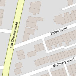
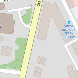

Leaflet © OpenStreetMap contributors
The heatmap indicates the level of crime in the area. The color of the heatmap indicates the crime severity and recency.
Metrics Year-on-Year
- Average area value
- 248,333.00 £Increased by 73.97 %
- Average area rental value
- 733.00 £/moIncreased by 10.39 %
- Est rental Yield
- 3.54 %Decreased by 36.56 %
- Crime Rate
- 13.00 %Unchanged by 0.00 %
from 142,743.00 £
from 664.00 £/mo
from 5.58 %
from 13.00 %
Nearby Schools
| Name | Type | Ofsted | Distance |
|---|---|---|---|
| Rock Ferry Primary School | Community School | Good | 0.49 KM |
| Rock Ferry Children'S Centre | Children's Centre | 0.55 KM | |
| Well Lane Primary School | Community School | Good | 0.57 KM |
| St Anne'S Catholic Primary School | Voluntary Aided School | Good | 0.83 KM |
| Bedford Drive Primary School | Community School | Good | 1.11 KM |
Images
Nearby Streets
| Name | Average Price | Average Sqft | Distance |
|---|---|---|---|
| Shakespeare Avenue | £ 0 | 0 | 0.00 KM |
| Well Lane | £ 0 | 0 | 0.00 KM |
| Medway Road | £ 0 | 0 | 0.00 KM |
| Orchard Court | £ 130,000 | 0 | 0.00 KM |
| Richardson Road | £ 130,000 | 0 | 0.00 KM |
Nearby Transport
| Name | NLC | TLC | Distance |
|---|---|---|---|
| Rock Ferry | 2189 | RFY | 0.41 KM |
| Green Lane | 2218 | GNL | 1.16 KM |
| Birkenhead Central | 2217 | BKC | 1.84 KM |
| Bebington | 2188 | BEB | 2.09 KM |
| Birkenhead Hamilton Square | 2219 | BKQ | 2.41 KM |
Nearby Listings
| Address | Price | Type | Score | Distance |
|---|---|---|---|---|
| Eldon Road, Rock Ferry, Birkenhead | £ 100,000 | BUY | 6 / 10 | 0.00 KM |
| Eldon Road, Birkenhead, Merseyside | £ 130,000 | BUY | 6 / 10 | 0.01 KM |
| 21 MULBERRY ROAD, BIRKENHEAD, MERSEYSIDE | £ 55,000 | BUY | 5 / 10 | 0.02 KM |
| Mulberry Road, Birkenhead, Merseyside, CH42 | £ 65,000 | BUY | 4 / 10 | 0.07 KM |
| Rockville Street, BIRKENHEAD, Merseyside, CH42 | £ 150,000 | BUY | Unknown | 0.10 KM |
Nearby Properties
| Address | Price | Distance |
|---|---|---|
| 10 Eldon Road | £ 93,000 | 0.00 KM |
| 12 Eldon Road | £ 41,300 | 0.00 KM |
| 16 Eldon Road | £ 149,000 | 0.00 KM |
| 13 Eldon Road | £ 61,000 | 0.00 KM |
| 15 Eldon Road | £ 15,250 | 0.00 KM |